
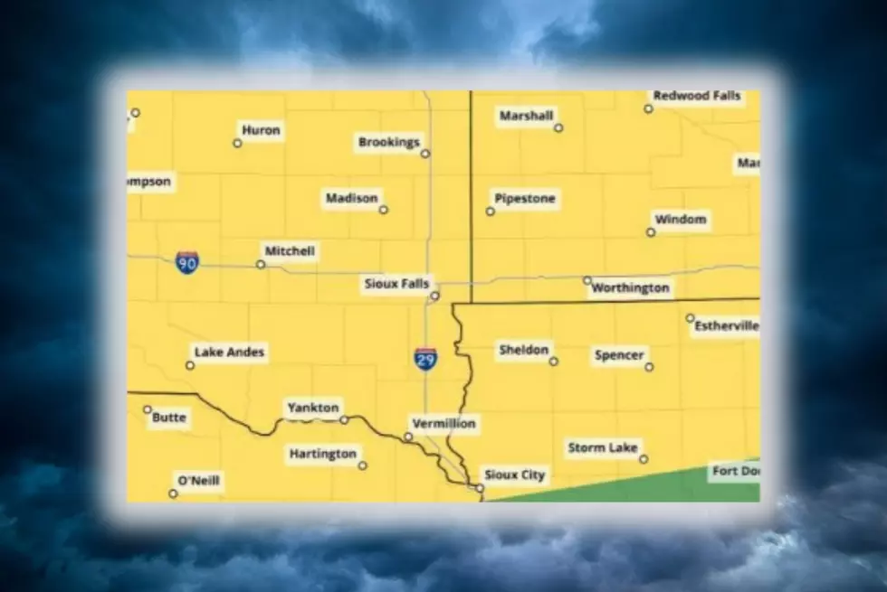
Severe Weather Possible Across Minnesota, Iowa And South Dakota
Severe weather could impact parts of South Dakota, Minnesota, and Iowa as thunderstorms develop and move across the region.
According to the National Weather Service in Sioux Falls, thunderstorms are expected to develop across central South Dakota later this afternoon before spreading east through the evening and overnight hours.

Some of the storms could become severe, with golf-ball-sized hail and wind gusts reaching 70 mph among the primary threats. An isolated tornado also cannot be ruled out during the evening.
Forecasters expect isolated to scattered thunderstorms to increase across central South Dakota during the late afternoon and early evening. As the storms move east, they could become more organized into a line.
During the evening and early overnight hours, more widespread 60-to-70 mph wind gusts could occur from southeastern South Dakota into northeastern Nebraska, southwestern Minnesota and northwestern Iowa.
Residents across the region should keep an eye on changing weather conditions and have multiple ways to receive weather alerts, especially if thunderstorms develop in their area.
The unsettled weather pattern isn't expected to end immediately. Periodic chances for thunderstorms will continue through Thursday, with additional spotty rain chances potentially continuing into the weekend.
At this point, widespread severe weather is not expected after Tuesday night, although an isolated strong storm cannot be completely ruled out.
Top 5 Worst Foods They Eat In Minnesota...Really!?
Gallery Credit: Worst Foods They Eat In Minnesota-Canva